
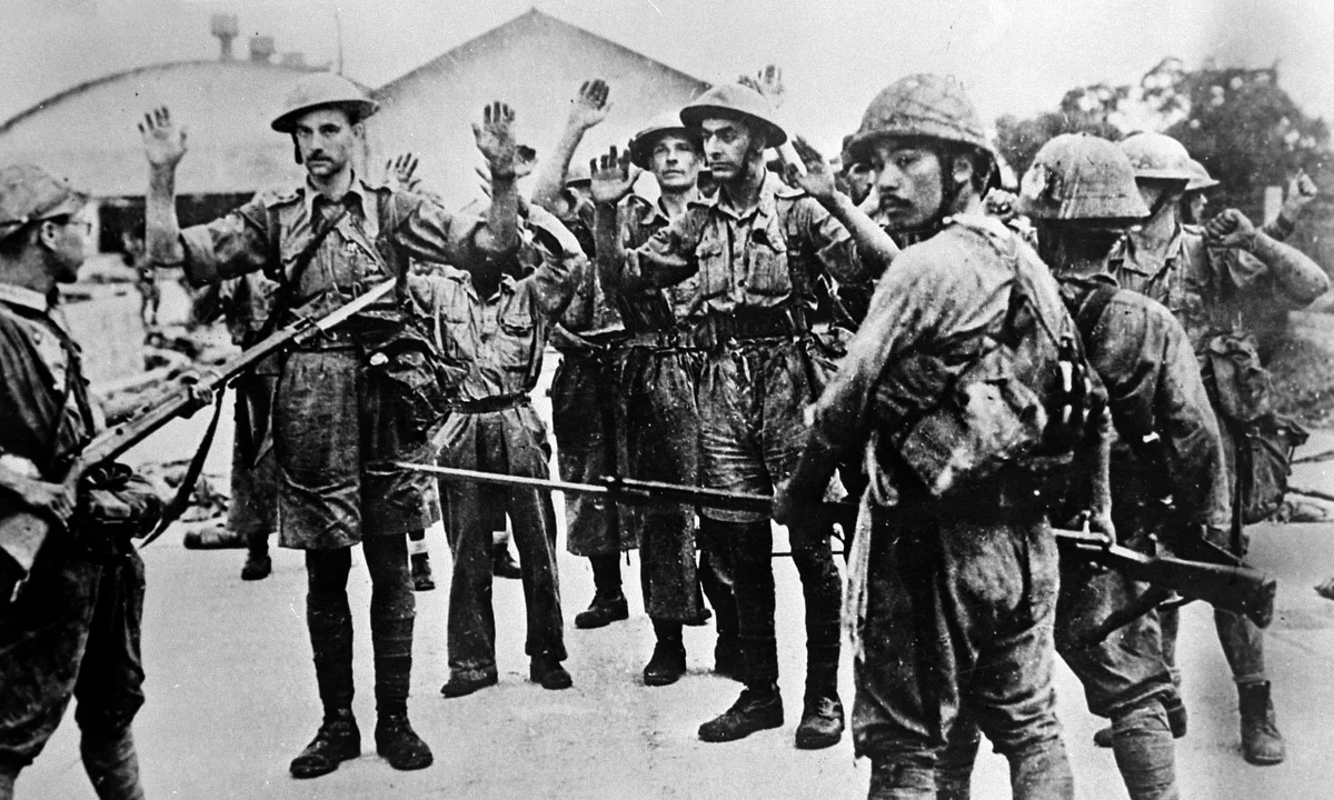
WWII History Trail Through Singapore: A Complete Guide to the Island’s Wartime Sites
Walk through Singapore’s WWII past with this complete guide to battlefields, bunkers, memorials, invasion beaches, and hidden wartime sites across the island.
Singapore WWII Historical Sites: A Complete Guide to the Island’s Wartime History
For most travelers, Singapore is a vision of the future: a neon-lit skyline, one of the world’s best airports, and the iconic “supertrees” of Marina Bay. But beneath the polished surface of the Lion City lies a much darker story of invasion, collapse, occupation, and survival. In 1942, this supposedly “impregnable fortress” fell to the Japanese in what Winston Churchill famously described as the “worst disaster” in British military history.
If you are a frequent flyer through Changi, a history-minded traveler, or simply someone looking to explore a side of Singapore beyond rooftop bars and Orchard Road, tracing the World War II story across the island offers a powerful new perspective. This is more than a list of monuments. It is a journey through invasion beaches, command bunkers, massacre sites, battle ridges, prison memories, airfields, barracks, and liberation landmarks that reveal how modern Singapore was shaped by one of the most dramatic campaigns in Southeast Asian history.
Timeline of World War II Sites in Singapore
This guide follows the chronological story of the Fall of Singapore, from the first bombs in 1941 to the invasion landings, the desperate final battles, the occupation years, and the liberation ceremony in 1945.
Quick Facts
- First bombing of Singapore: 8 December 1941
- Japanese invasion landings: 8 February 1942
- British surrender at Ford Factory: 15 February 1942
- Liberation ceremony at City Hall: 12 September 1945
Singapore’s wartime story is not confined to just a handful of famous places. The National Heritage Board’s WWII trail identifies 50 war sites across six themed regions of the island, ranging from invasion beaches and command centres to massacre sites, memorials, barracks, and occupation-era landmarks.
Interactive Map of Singapore’s WWII Historical Sites
Explore the full WWII trail across Singapore, from the first bombings and invasion beaches to bunkers, battlefields, occupation sites, and liberation landmarks.
Save this map before you go: open it in Google Maps, star the places you want to visit, and use the route sections below to plan a half-day or full-day WWII history trail across Singapore.
1. First Bombing of Singapore — Raffles Place (December 8, 1941)
The war in the Pacific did not begin for Singapore as an abstract headline from somewhere else. It arrived directly over the island. In the early hours of 8 December 1941, Japanese aircraft struck the city, bringing war to the colonial capital and shattering the belief that Singapore was safely beyond the reach of modern conflict.
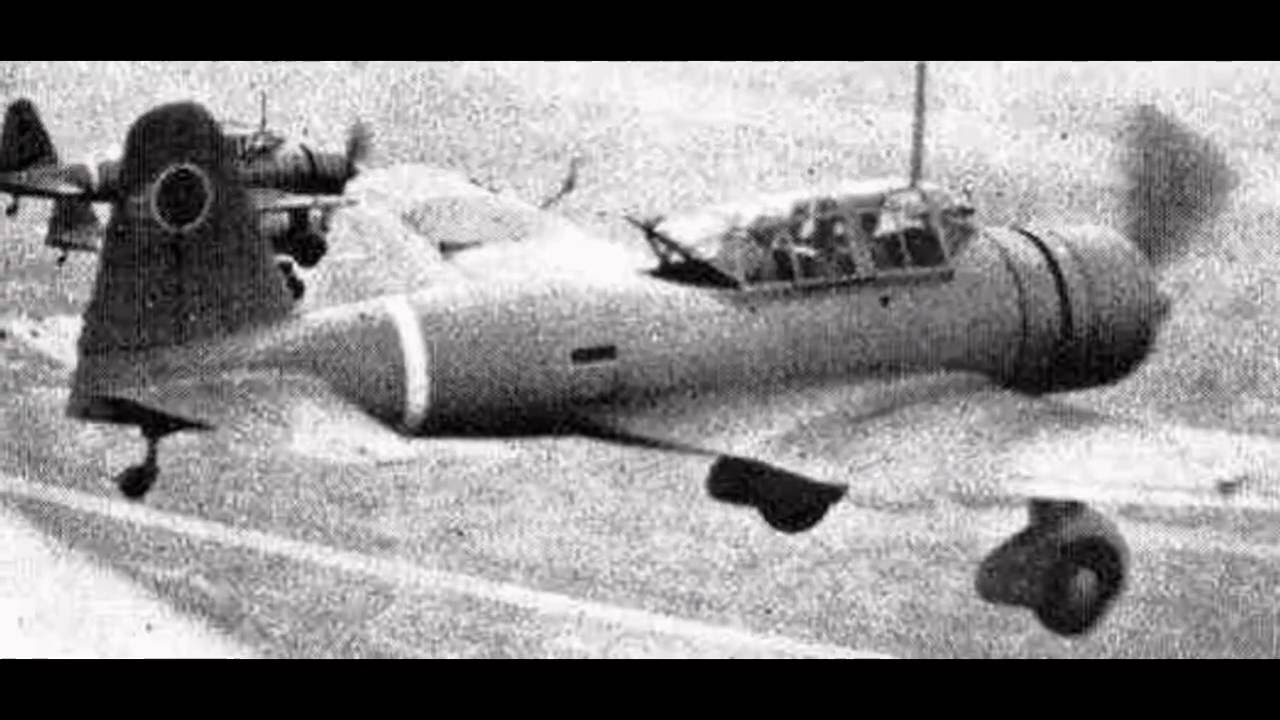
Where it happened: The Raffles Place area and nearby airfields like Seletar.
Significance
The first air raid destroyed more than buildings and routines. It punctured the myth of security that had surrounded British Singapore for years. The colony had long been marketed as a fortress protected by naval power, military planning, and the confidence of empire. Yet when the bombs fell, it became clear that the city itself was exposed, and that civilians in the commercial center were now part of the war zone.
The bombing also highlighted a deeper strategic failure. British defence planning had focused heavily on the idea of an attack from the sea, but Japan’s campaign was unfolding through Thailand and down the Malay Peninsula. Air power became the first unmistakable sign that the assumptions behind Fortress Singapore were already collapsing.
For residents, this was not just a military event. It marked the beginning of blackout drills, air-raid sirens, fear, rumours, displacement, and a new daily psychology of uncertainty. The war was no longer distant. It had entered the heart of the city.
What it is now
Today it is Singapore’s financial district, full of office towers, MRT exits, and fast-moving commuters. That contrast is precisely what makes it such a compelling historical stop: one of the busiest business districts in Asia was also one of the places where war first announced itself on the island.
2. The Air War Over Singapore — Kallang & Tengah Airfields (December 1941)
Where it happened
- Kallang Airfield
- Tengah Airfield
Significance
Japanese bombing raids destroyed much of the RAF’s air capability early in the war.
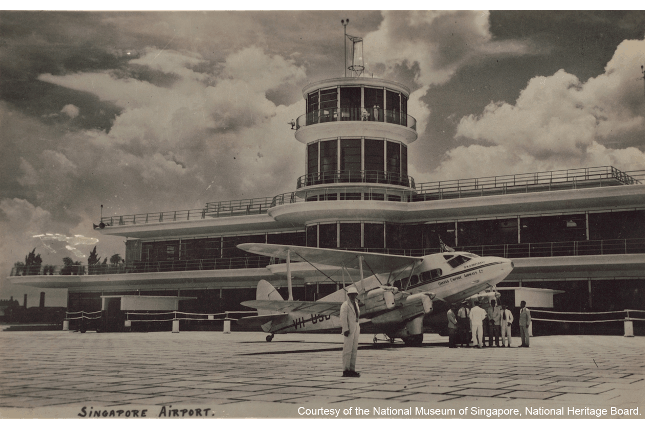
Kallang and Tengah were vital pieces of Singapore’s air defence system, and their vulnerability revealed how quickly the island could be isolated from the sky. Kallang, then one of the region’s important aviation hubs, had both civil and military importance. Tengah was a major RAF base and a key part of the defensive network expected to shield Singapore from attack.
Once Japanese air superiority grew, the wider campaign became dramatically harder for the defenders to sustain. Japanese aircraft could bomb airfields, ports, troop positions, and civilian zones while also protecting their own advancing ground forces. This was not simply a tactical loss. It undermined communications, disrupted movement, weakened morale, and left the island increasingly open to repeated attack.
Once air superiority was lost:
- Japanese troops could land with air cover
- Singapore became vulnerable to constant bombing
- British defenses weakened rapidly
The collapse of the air defence system also had enormous psychological importance. Every successful raid reinforced the feeling that British claims of preparedness had been overstated. The sound of aircraft overhead became a signal that the campaign was accelerating, and that the defenders were steadily losing control of the battlespace above the island.
What it is now
The old Kallang Airport terminal building still survives today as a heritage landmark, connecting aviation history with wartime memory.
Tengah remains an active RSAF base, which creates a striking continuity: it is still associated with air power and national defence, even though the strategic context is now entirely different.
3. The Causeway Explosion — British Retreat to Singapore (Jan 31, 1942)
Where it happened
Johor–Singapore Causeway.
Significance
As Japanese troops advanced down the Malay Peninsula, British forces retreated to Singapore Island and blew up the causeway in an attempt to slow the invasion.
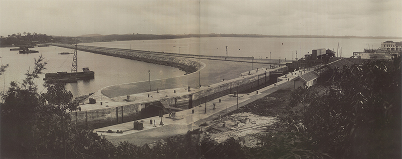
The demolition of the causeway was one of the most symbolic moments of the entire campaign. It marked the end of the land battle in Malaya and the beginning of the final defensive phase on Singapore Island. Militarily, the destruction was intended to slow Japanese armour, transport, and logistics. Symbolically, it was an unmistakable admission that British forces had been pushed all the way back to their last major stronghold.
Yet the advantage was short-lived. Japanese engineers repaired the crossing with remarkable speed, demonstrating how adaptable and operationally efficient the invasion force had become. What the British hoped would buy valuable time instead became another sign that momentum now belonged overwhelmingly to the attackers.
The retreat itself also told its own story. Units arriving on Singapore were exhausted, communications were stretched, and confidence had eroded. By the time the defenders regrouped on the island, they were already fighting from a position of strain.
What it is now
Still the busiest land border crossing in Southeast Asia.
For many people today, the causeway is simply part of the daily rhythm of commuting and cross-border travel. In early 1942, however, it was one of the most strategically significant links in the region and one of the last thresholds between retreat and invasion.
4. The Japanese Landings — Sarimbun Beach (Feb 8, 1942)
Where it happened
Significance
Japanese troops crossed the Johor Strait using collapsible boats and landed here.
Australian defenders fought fiercely but were overwhelmed.
This landing allowed Japanese forces to advance toward Singapore’s reservoirs and airfields.
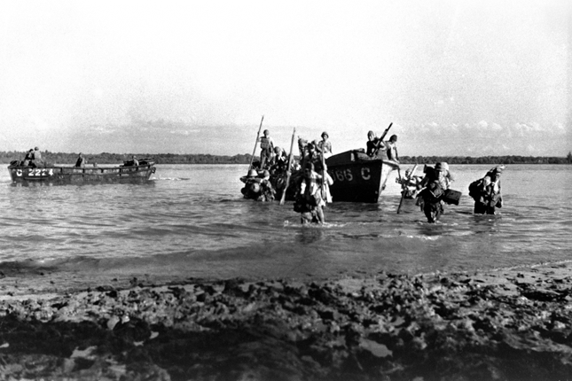
The northwest coast was considered difficult ground: muddy shoreline, mangroves, inlets, and confusing terrain. That was exactly what made it such an effective point of attack. The Japanese crossed at night, used artillery and deception effectively, and established beachheads before the defenders could recover the initiative.
For the Australian units defending this sector, the challenge was not a lack of resistance but the sheer difficulty of the situation. The front was wide, visibility was poor, communications were unreliable, and the Japanese had already built momentum from their rapid advance down the peninsula. Once the beachheads were secured, the invasion quickly became an inland breakthrough.
Sarimbun mattered because it opened the door to the western side of Singapore. From here, Japanese troops could move toward Tengah, threaten the Kranji-Jurong line, and begin rolling up the island’s defences from the northwest inward. It was one of the moments when the invasion stopped being a threat and became a reality on Singapore soil.
Nearby historical terrain
- Sungei Buloh Wetland Reserve
- Lim Chu Kang coastal areas
These mangroves and coastal stretches still give some sense of the terrain that shaped the battle. Even today, this part of Singapore feels less urban and more physically open, which makes it one of the most evocative places to imagine how disorienting the fighting must have been.
5. Battle for Singapore’s Water Supply — Bukit Timah (Feb 11, 1942)
Where it happened
Bukit Timah Hill.
Why it mattered
Bukit Timah controlled:
- Singapore’s highest point
- fuel depots
- water reservoirs
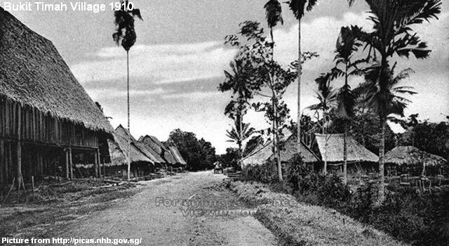
Bukit Timah was one of the most important objectives in the Battle of Singapore because it combined geography, logistics, and infrastructure. It commanded high ground, connected major roads, and lay close to fuel depots and reservoir systems vital to sustaining the defence of the city.
Once the Japanese captured Bukit Timah, the British position deteriorated rapidly. The defenders were already under immense pressure, but the fall of this area made it even harder to organise a coherent final line. Water supply had become a growing concern, and control of the high ground added to the sense that the military situation was becoming irreversible.
The fighting around Bukit Timah also shows how fast the campaign moved. Within only a few days of the landings, Japanese forces had pushed from the coast into one of the most strategically critical interior zones on the island. That speed was one of the defining features of the campaign.
What it is now
Bukit Timah Nature Reserve — one of Singapore’s best hiking areas.
That modern identity makes the site especially striking. What is now known for jungle trails, fitness climbs, and biodiversity was once a decisive military objective connected to supply, survival, and the final unravelling of Singapore’s defence.
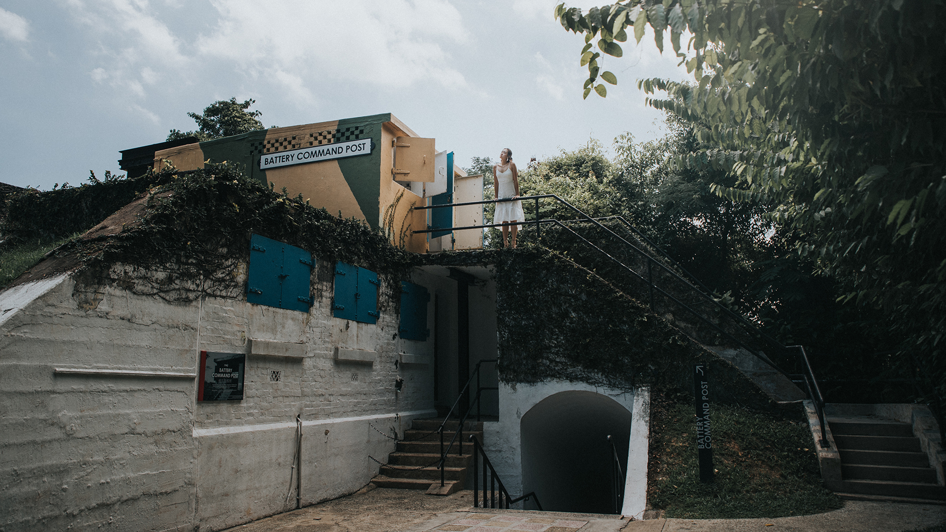
6. British Command Headquarters — The Battle Box (Feb 1942)
Where it happened
Significance
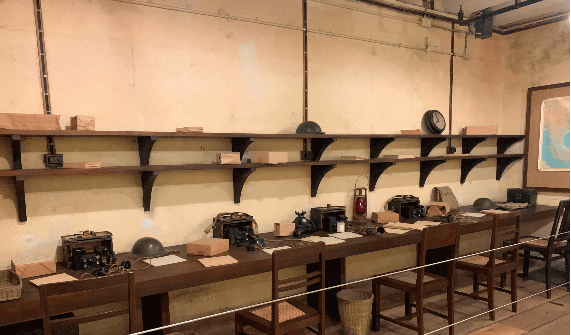
This underground bunker served as the command center for British forces during the battle.
Here, Lieutenant-General Percival made the decision to surrender Singapore.
More than simply a bunker, the Battle Box was the nerve centre of British and Allied command during the final days of the campaign. Buried beneath Fort Canning, it was built to withstand bombing and to support operational planning, communications, and staff work while the battle closed in above ground.
By the time Percival was operating from here, the strategic picture was already dire. Front lines were contracting, reserves were strained, vital positions had been lost, and the defenders faced growing shortages. The bunker’s maps, telephones, and operations rooms represented an attempt to maintain military order under rapidly worsening conditions.
This is what gives the Battle Box its emotional and historical weight. It was not the single place where everything suddenly changed, but the place where the consequences of failed assumptions, battlefield setbacks, and collapsing defensive options became impossible to ignore.
Today
A museum you can visit beneath Fort Canning Hill.
It remains one of the most atmospheric WWII sites in Singapore because it lets visitors experience the confined, tense, and decision-heavy environment in which the fate of the island was being debated.
7. Hidden Coastal Defenses — Labrador Battery
Where it happened
Labrador Nature Reserve.
Significance
This battery protected the entrance to Keppel Harbour.
The defenses included:
- coastal artillery guns
- underground ammunition tunnels
- observation bunkers
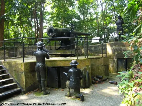
Labrador Battery was part of the wider ring of coastal defences that reflected British assumptions about how Singapore would be attacked. The guns and underground structures here were built to defend the harbour approaches and the southern coastline, which had long been viewed as the likeliest direction of a major assault.
The site is especially useful for unpacking one of the most repeated myths about the fall of Singapore: that the guns were useless because they only faced the sea. In reality, some could be turned inland. The larger problem was not simply direction, but doctrine and ammunition. Many of the heavy guns were better suited to engaging ships than dispersed ground forces advancing across land.
Labrador therefore tells a larger story about the war: impressive fortifications do not help much when the enemy attacks in ways the defenders did not truly prioritise. It is a site where architecture, planning, and strategic misjudgment all become visible at once.
Interesting myth
The guns could turn inland — but they had armor-piercing shells designed for ships.
That makes Labrador one of the best places in Singapore to understand not just what happened, but why the fortress concept failed when the real invasion came from the north.
8. The Alexandra Hospital Massacre (Feb 14, 1942)
Where it happened
Alexandra Hospital.
What happened
Japanese troops entered the hospital grounds and killed doctors, nurses, and wounded soldiers.
Around 200 people were murdered.
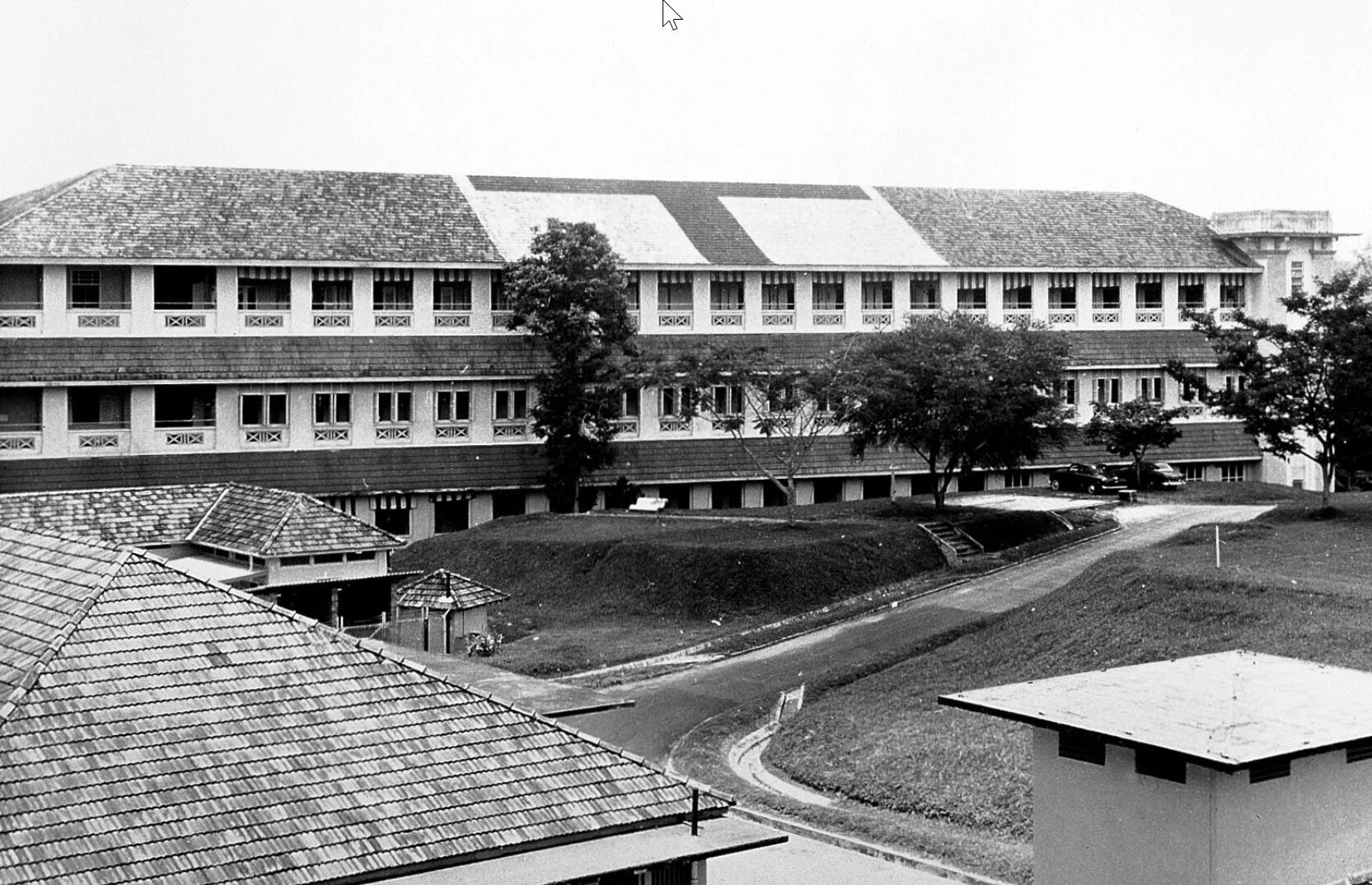
The Alexandra Hospital massacre remains one of the most horrifying episodes of the fall of Singapore. The hospital, originally the British Military Hospital, should have been a protected medical zone. Instead, as the fighting moved across the western part of the island, it became engulfed by the violence of the collapsing front.
After entering the grounds, Japanese troops attacked staff, patients, and wounded men who were in no position to defend themselves. The massacre became one of the clearest examples of the brutality that accompanied the final days of the battle and foreshadowed the suffering that many would endure during the occupation.
The site is important not only because of the scale of the atrocity but because of what it represents. A hospital is supposed to stand apart from combat as a place of care and refuge. Here, that boundary disappeared completely. It is one of the moments in the story of Singapore where the moral shock of war becomes especially stark.
What it is now
A working hospital with a memorial plaque.
It is a deeply sobering stop because the site remains associated with healing, even though its wartime memory is inseparable from trauma, grief, and the loss of the wounded who should have been protected.
9. The Last Stand — Bukit Chandu (Feb 14, 1942)
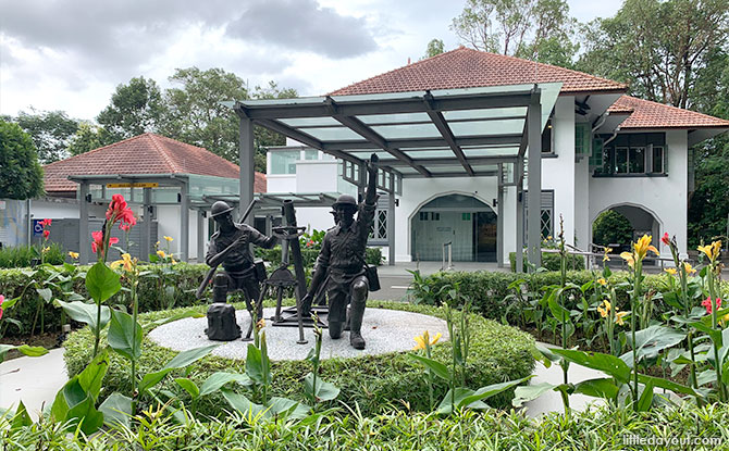
Where it happened
Opium Hill (Bukit Chandu).
Significance
The Malay Regiment fought to the last man against Japanese troops.
Lieutenant Adnan Saidi became a national hero.
Bukit Chandu was one of the final and fiercest positions in the Battle of Pasir Panjang. The ridge overlooked a strategically important corridor leading toward military installations, depots, and the Alexandra area. If this line failed, the southwestern approach to the city became even more exposed.
The battle here has taken on a central place in Singapore’s wartime memory because of the stand made by the Malay Regiment, especially the men associated with Lieutenant Adnan Saidi. Outnumbered, exhausted, and under intense pressure, they continued fighting despite overwhelming odds. The story of disguised Japanese troops and the defenders’ refusal to yield has become one of the island’s most enduring wartime narratives.
Bukit Chandu is remembered not because it altered the final outcome, but because it symbolizes sacrifice, discipline, and resistance. It is one of the places where Singapore’s WWII history becomes intensely personal and local rather than purely imperial or strategic.
Today
The museum and surrounding ridge remain among the most powerful places in Singapore to understand how local and regional troops fought, not just British formations in the abstract.
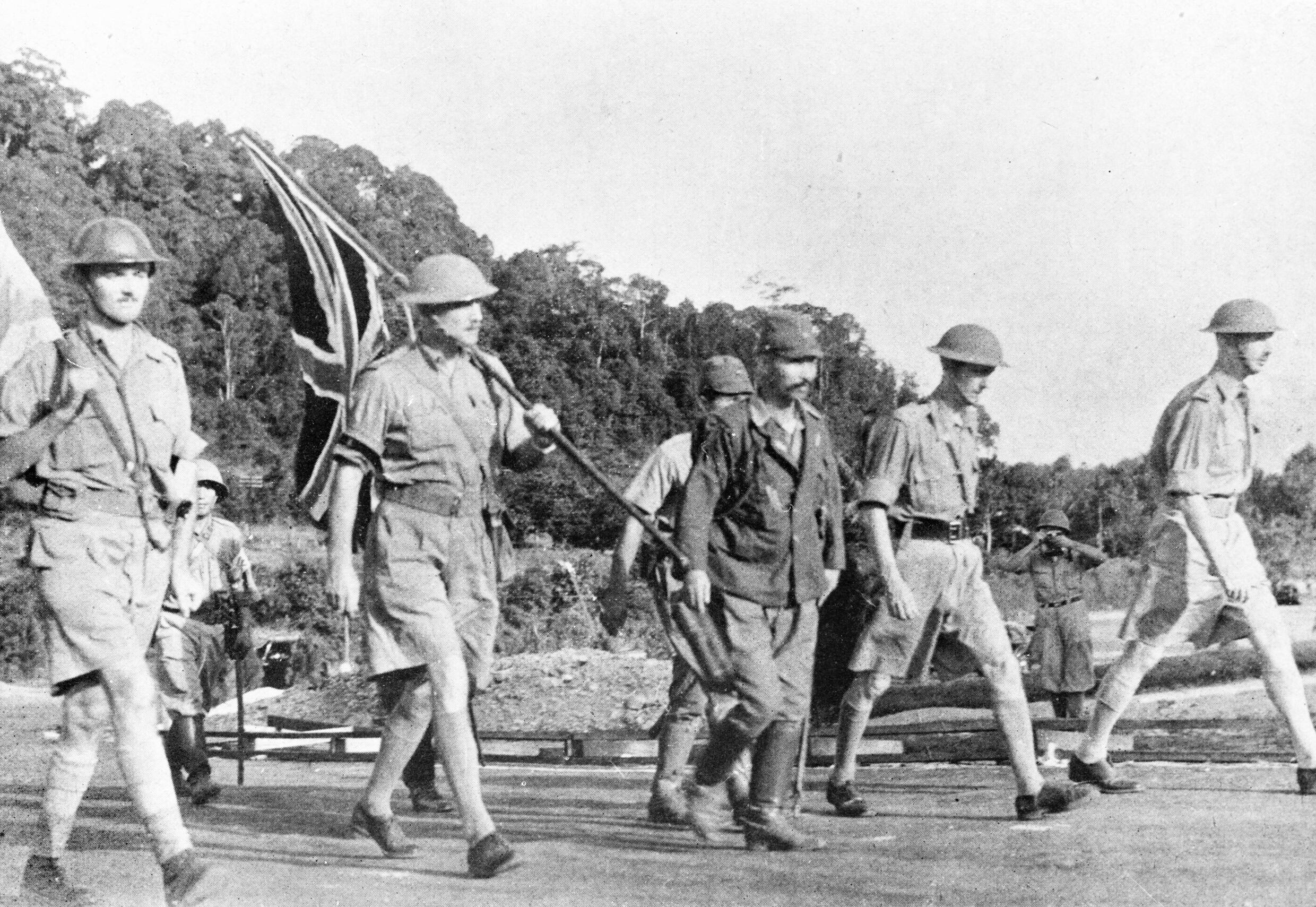
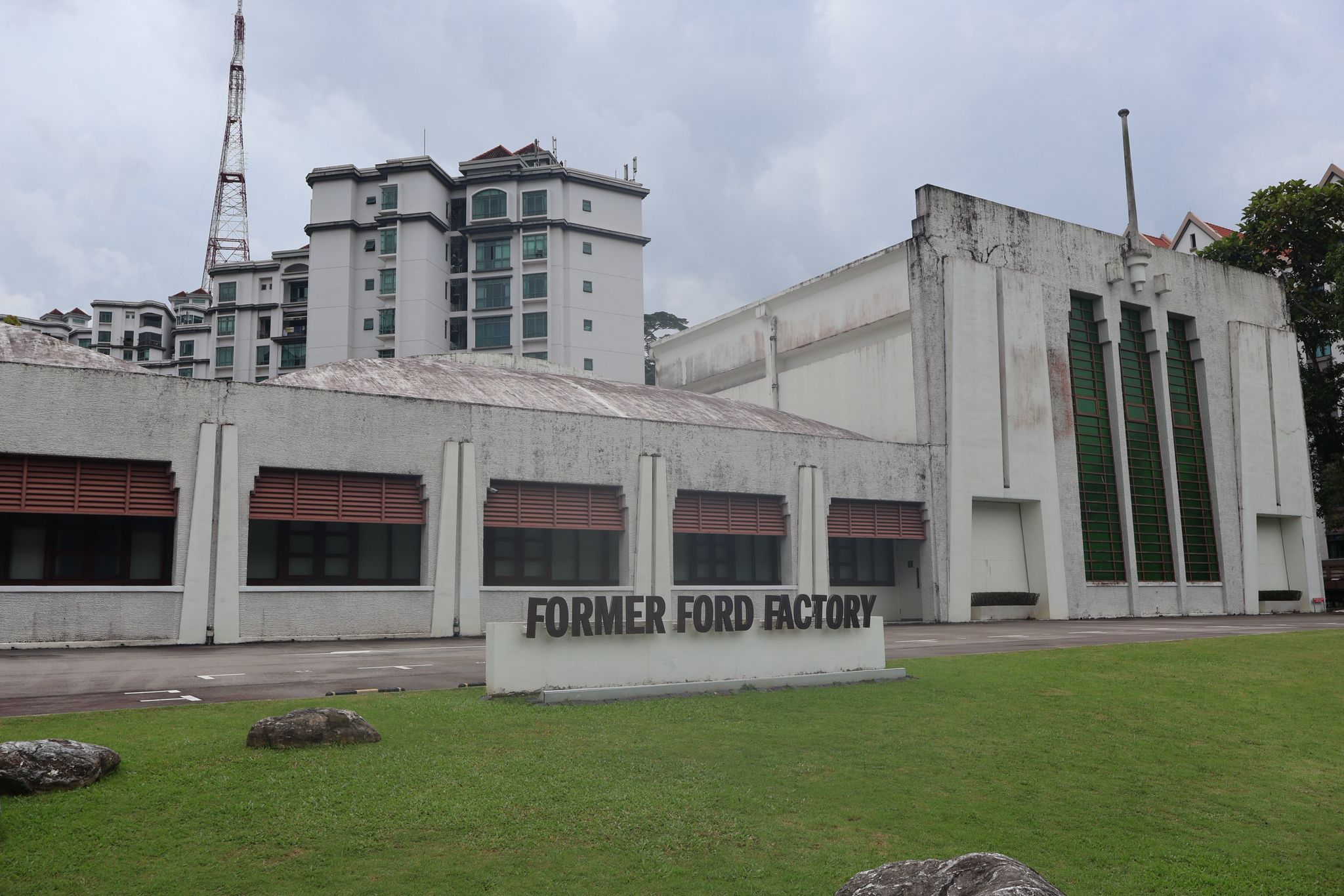
10. The British Surrender — Old Ford Factory (Feb 15, 1942)
Where it happened
Significance
General Percival surrendered Singapore to General Yamashita here.
Singapore was renamed Syonan-to.
The Ford Factory boardroom is one of the most consequential interiors in Singapore history. On 15 February 1942, after a campaign that had moved with extraordinary speed down Malaya and across Singapore Island, Lieutenant-General Arthur Percival met Lieutenant-General Tomoyuki Yamashita and surrendered the island.
The significance of that moment went far beyond Singapore. The fall of the island marked the collapse of a major British imperial stronghold in Asia and dealt a severe blow to British prestige. It sent shockwaves through the region and changed how colonial power would be viewed in the years that followed.
For people on the island, this was the dividing line between battle and occupation. After the surrender, Singapore entered three and a half years of Japanese rule under the name Syonan-to, often translated as “Light of the South.” The end of the battle did not bring relief. It marked the beginning of a different kind of hardship.
Today
The Former Ford Factory is now a World War II exhibition space that helps visitors connect the drama of the surrender room with the broader human story of invasion, occupation, captivity, and memory.
11. The Occupation Years — Changi & Sook Ching (1942-1945)
Where it happened
Significance
Thousands were executed during the Sook Ching purge.
Allied POWs were imprisoned at Changi.
The wartime story of Changi combines several overlapping histories of suffering. It is internationally remembered for the prisoner-of-war camps, where captured Allied soldiers endured overcrowding, disease, forced labour, poor nutrition, and deep uncertainty about survival. At the same time, the wider Changi area became associated with detention, punishment, and the violence of occupation.
This period also overlaps with the Sook Ching purge, in which the Japanese targeted Chinese civilians suspected of anti-Japanese sentiment. Men were screened, separated, detained, and in many cases taken away to be executed. Coastal sites such as Changi Beach later became associated with these killings and with the wider fear that defined daily life under occupation.
To visit Changi as a WWII site is to confront the occupation in its full human depth: military captivity, civilian terror, family separation, endurance, memory, and grief. It is a part of the story that shifts the lens from battlefield manoeuvres to the lived experience of occupation.
Today
The museum is one of the best places in Singapore to understand wartime life through letters, personal testimonies, reconstructed spaces, and small human objects rather than military movements alone.
12. Allied Sabotage — Operation Jaywick (1943)
Where it happened
Singapore Harbour.
What happened
Australian commandos infiltrated Singapore harbor using folding kayaks.
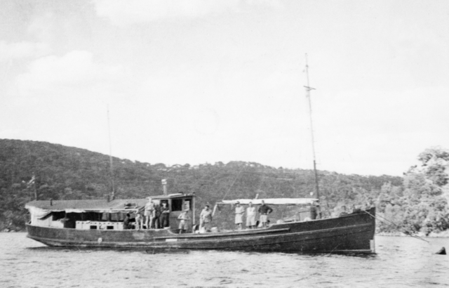
They planted mines on Japanese ships and escaped.
Operation Jaywick was one of the boldest Allied commando raids of the war in Southeast Asia. A small team travelled deep into enemy-controlled waters, approached occupied Singapore in disguise, and launched folding canoes to infiltrate the harbour. Their mission was to attack Japanese shipping in one of the most strategically important ports in the region.
The raid mattered not only because of the physical damage it caused, but because of what it symbolized. Occupied Singapore was supposed to be secure. Jaywick proved that it could still be penetrated by daring, careful, unconventional operations. At a time when Allied fortunes in Asia had been badly shaken, the raid carried significant psychological value.
It also broadens the story of WWII sites in Singapore beyond beaches, bunkers, and surrender rooms. The harbour was central to both Japanese power and Allied efforts to disrupt that power. Jaywick reminds visitors that the war around Singapore was also maritime, covert, and international in character.
Seven ships were sunk or damaged.
13. Liberation of Singapore — City Hall (Sept 12, 1945)
Where it happened
City Hall / Padang.
Significance
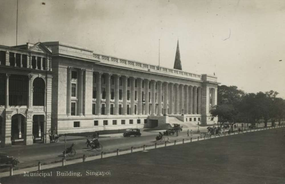
Admiral Mountbatten accepted the Japanese surrender here.
The ceremony at the Municipal Building, now part of the National Gallery Singapore precinct, marked the formal public end of the Japanese occupation in Singapore. The location mattered deeply. This was the civic heart of colonial Singapore, and it became the setting for a ceremony of liberation, military theatre, and political symbolism.
Where the surrender at the Ford Factory had signaled imperial collapse and the beginning of occupation, the ceremony at City Hall signaled the restoration of authority and the visible end of wartime rule. It did not erase suffering overnight, but it marked a turning point in how the war would be remembered and how the postwar city would reimagine itself.
The Padang and Civic District therefore bookend the wartime story. The city centre that felt the shock of bombing at the start of the campaign became, by 1945, the stage on which occupation formally came to an end.
Today
Standing here now, surrounded by museums, government buildings, and open civic space, it can be difficult to imagine the same setting as the scene of one of the most important surrender ceremonies in Southeast Asia.
More WWII Sites to Add to the Map
Beyond the better-known stops above, there are many more Singapore WWII sites worth adding if you want the guide to feel complete. These places help tell the full wartime story across the six regions highlighted in Singapore’s official WWII trail: north-west, north-east, central, south, city, and east.
North-West: Invasion and the First Battles
Lim Chu Kang Landing
Often paired with Sarimbun Beach in WWII histories, Lim Chu Kang Landing was one of the invasion sectors where Japanese forces crossed the Johor Strait on the night of 8 February 1942. The Australian defenders were spread thin along a very broad coastline, and the Japanese used artillery, darkness, and repeated crossings to overwhelm the sector. Lim Chu Kang is especially important because Lieutenant-General Yamashita himself was able to come ashore in this area soon after the landings.
Ama Keng Village
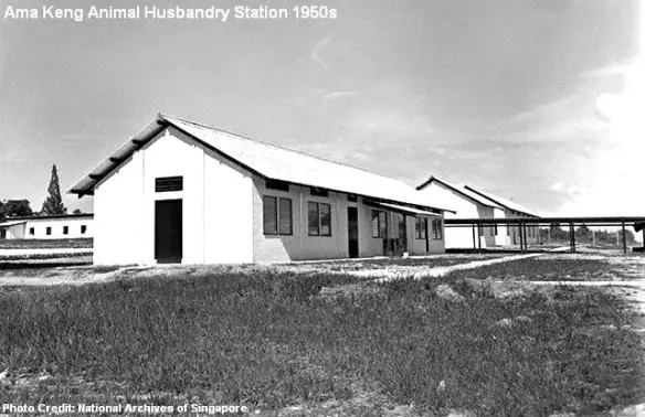
Ama Keng Village sat near the headquarters of the 22nd Australian Brigade. Because the defenders had too few troops to hold the whole coastline in depth, the area became part of the hurried reorganisation and retreat after the first breakthrough. It matters less as a surviving monument than as a piece of battlefield geography: it helps explain how the north-western defence line unravelled once the invasion had begun.
Jurong-Kranji Defence Line
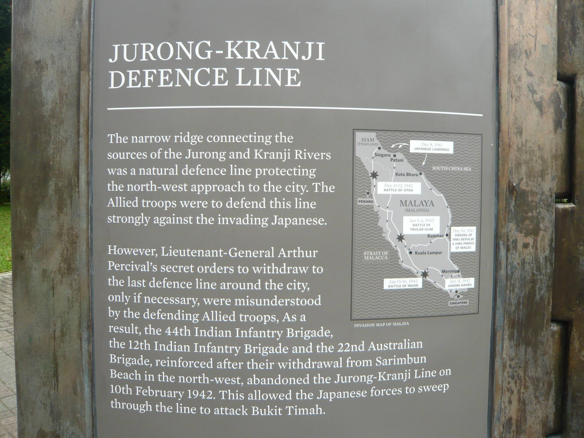
The Jurong-Kranji Defence Line was intended as a major fallback line after the invasion beaches were breached. It stretched across western Singapore and represented an effort to stabilise the defence of the island after the initial landings. The line is important because it reveals that the British did have secondary defensive plans, but those plans were undermined by speed, confusion, communication problems, and the rapid Japanese advance inland.
Kranji Beach Battle
The fighting at Kranji Beach formed part of the intense struggle for the north-western sector after the initial landings. The area saw fierce clashes as Japanese troops pushed across the straits and sought to widen their hold on the island. Kranji also later became closely associated with remembrance, which makes it one of those places where battlefield history and memorial history overlap in especially powerful ways.
Kranji War Cemetery
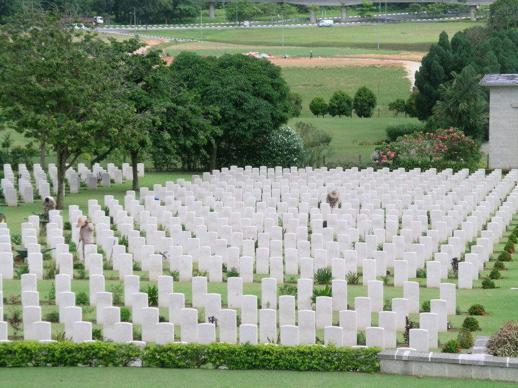
You already mention Kranji in your hidden-sites section, but it is worth expanding. Kranji War Cemetery is one of the most important memorial landscapes in Singapore, containing the graves of Allied servicemen who died in the Malayan campaign, the Battle of Singapore, and captivity during the occupation. It turns abstract casualty numbers into something personal and immediate, and is one of the most reflective stops on any WWII route through the island.
North-East: The Defence Strategy and Its Consequences
Singapore Naval Base
The Singapore Naval Base at Sembawang was central to the entire idea of “Fortress Singapore.” Built as a major British naval installation, it embodied the belief that the island could be defended through sea power and imperial reinforcement. Its importance lies not in one dramatic battle scene, but in what it symbolised: the strategic assumptions on which British confidence rested before the Japanese campaign exposed how vulnerable Singapore really was.
Sembawang Airfield
Sembawang Airfield was one of the key RAF sites in northern Singapore and part of the broader military network supporting the defence of the island. Along with Tengah, Seletar, and Kallang, it shows how important aviation was to the campaign. Once these airfields came under pressure and British air strength weakened, the defence of Singapore became far harder to sustain.
Seletar Airfield
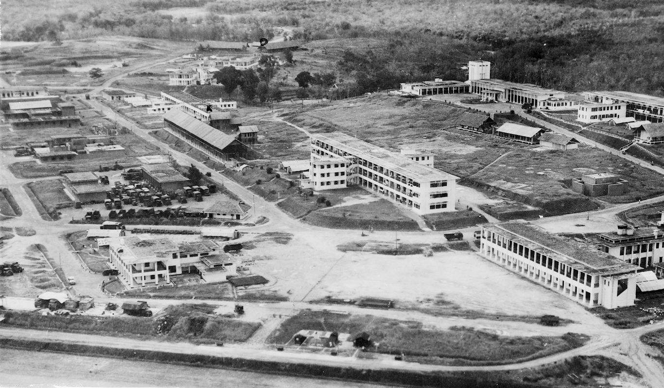
Seletar Airfield has a special place in the opening phase of the war because it was one of the areas affected by the first Japanese bombing raids. It helps connect the story of central Singapore’s first shock at Raffles Place with the broader military reality that airfields across the island were also immediate targets. Adding Seletar makes the early-war story feel much fuller and more grounded.
Punggol Beach Massacre
You already mention Punggol Beach in the hidden-sites section, but it is one of the most important civilian sites in Singapore’s wartime landscape. It became one of the known execution grounds of the Sook Ching purge, in which Chinese civilians suspected of anti-Japanese sentiment were screened, taken away, and killed. The quiet shoreline today makes the violence that happened here feel even more haunting.
Japanese Cemetery Park
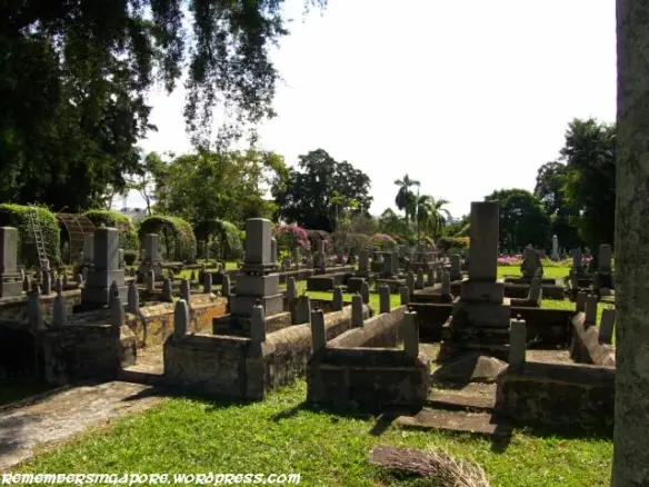
Japanese Cemetery Park is not a battlefield site in the conventional sense, but it adds a valuable layer to the island’s WWII memory landscape. It became the resting place for Japanese civilians and, later, the transferred ashes of Japanese war dead. Its significance lies in remembrance, mourning, and the complicated afterlives of wartime memory, rather than in combat itself.
Central: Battle for the Heart of Singapore
Bukit Batok Memorial
Bukit Batok Memorial is one of the more layered WWII sites in Singapore. Originally linked to wartime commemorative efforts under the Japanese, it later became associated with memory, destruction, and reinterpretation after the war. It stands near the battlefield zone of Bukit Timah and helps bridge the story between battle, occupation, and remembrance.
Force 136 & Grave of Lim Bo Seng
This site brings together resistance history and personal sacrifice. Lim Bo Seng was one of Singapore’s best-known wartime heroes and became associated with Force 136, the British-linked resistance and intelligence effort in the region. His burial site and memorial significance make this one of the most important places for understanding that Singapore’s wartime story was not only about defeat and occupation, but also about clandestine resistance.
South: Final Battles and Their Consequences
Pasir Panjang Machine-Gun Pillbox
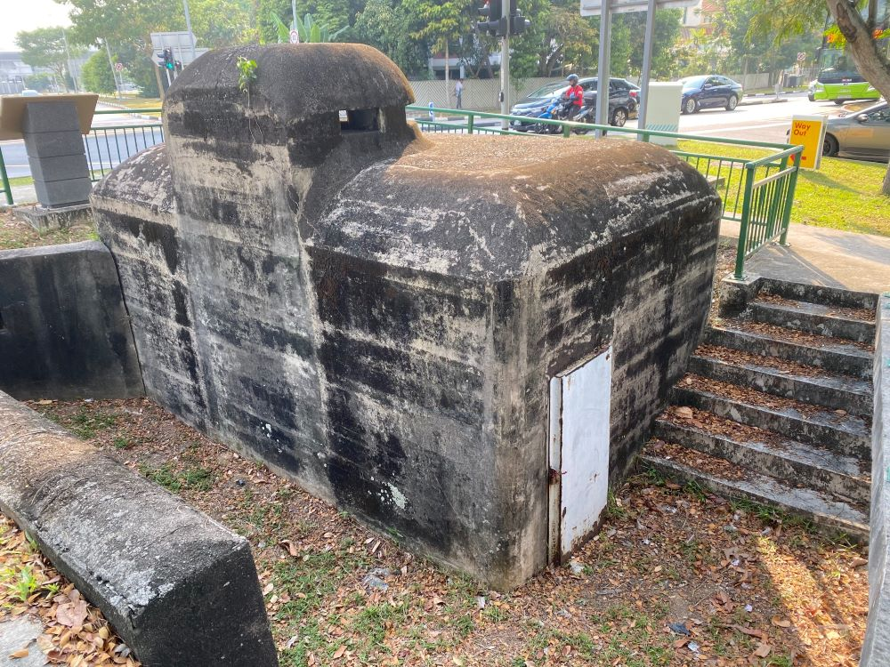
The Pasir Panjang Machine-Gun Pillbox is one of the most tangible surviving reminders of battlefield fortification in the southwest. Small compared with famous museums, it is still highly valuable because it shows the physical reality of defence: not just grand strategy, but reinforced concrete, firing positions, and prepared kill zones. It helps visitors imagine how the ground war was meant to be fought.
Kent Ridge Park
Kent Ridge Park gives broader terrain context to the Battle of Pasir Panjang and the last stands associated with Bukit Chandu. The ridge line, road approaches, and surrounding high ground mattered greatly during the final battles. This is one of the best places to understand that the fighting in the southwest was not confined to a single hilltop, but spread across an interconnected defensive landscape.
Siloso Battery
You mention Fort Siloso later, but the wartime site is more precisely understood through Siloso Battery, part of the coastal artillery system on what is now Sentosa. Together with Labrador, it helps show how southern Singapore was fortified against naval attack. It is one of the clearest surviving examples of the original defensive concept behind Fortress Singapore.
Sentosa Beach
Sentosa Beach appears in the wartime trail because the island’s southern coastline and nearby military installations formed part of the broader harbour defence network. It is useful as a reminder that places now associated with leisure and tourism were once embedded in Singapore’s military landscape. That contrast is one of the most striking things about exploring WWII sites on the island.
Keppel Harbour
Keppel Harbour was strategically vital both before and during the occupation. It was part of the port infrastructure that made Singapore such an important imperial and wartime hub, and later became associated with covert Allied operations such as Operation Jaywick. Adding Keppel Harbour makes the maritime side of the war much easier to visualise.
Execution of Captured Rimau Commandos
This site is one of the most sobering follow-ups to the story of Jaywick. Operation Rimau was a later Allied commando attempt against Japanese shipping, and the captured men were eventually executed. Including this location expands the harbour story beyond successful sabotage and shows the risks, failures, and grim consequences of covert warfare in occupied Singapore.
City: Remembering the Japanese Occupation
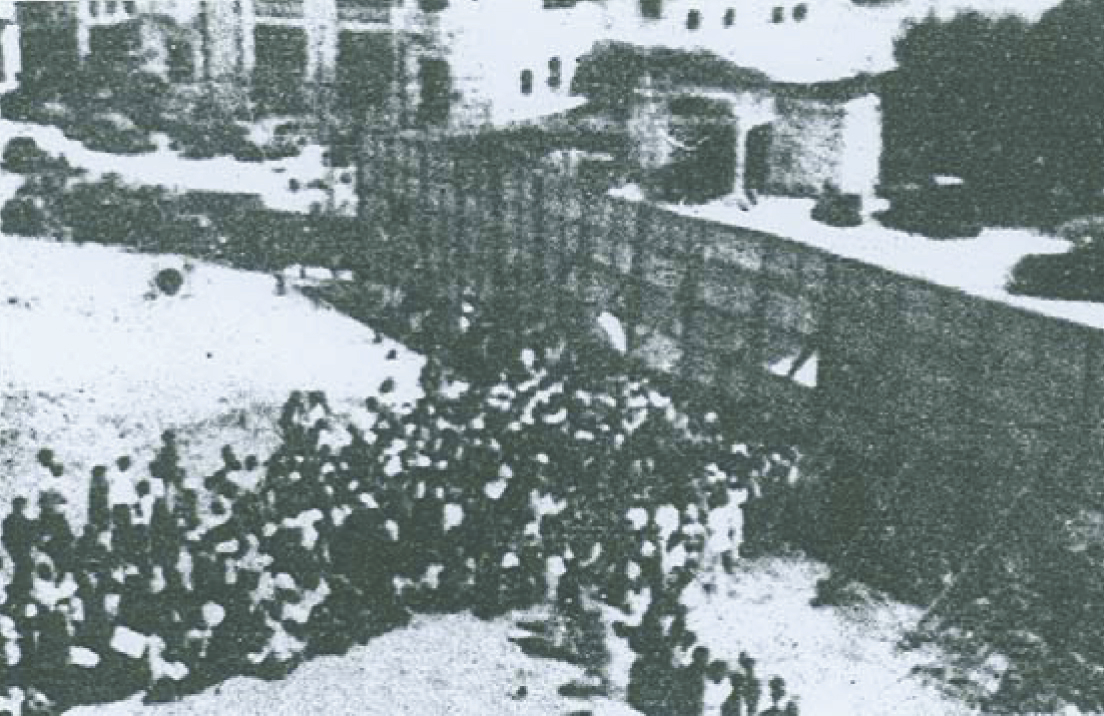
Sook Ching Inspection Centre (Hong Lim Complex area)
The Sook Ching Inspection Centre near the Hong Lim area is one of the most important occupation sites in central Singapore. During the purge, Chinese males were screened for suspected anti-Japanese sentiment. For many families, the screening process was the moment when relatives disappeared forever. This site makes the machinery of occupation visible in a very urban, everyday setting.
Former Cathay Building
The Former Cathay Building became one of the most important public and symbolic structures during the occupation. It was used by the Japanese for propaganda and administration, and its prominence in the city made it a visible marker of new power. It is a useful reminder that occupation was not only military and violent, but also theatrical, ideological, and deeply embedded in civic space.
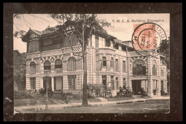
Kempeitai East District Branch (YMCA)
The former YMCA building, associated with the Kempeitai East District Branch, is one of the darkest sites in wartime Singapore. The Kempeitai, the Japanese military police, became synonymous with interrogation, torture, fear, and arbitrary arrest. Including this site is essential if the article aims to convey the true texture of occupation, not just its dates and political milestones.
National Museum of Singapore
The National Museum of Singapore is not only a museum today; it is also part of the wartime story. During the Japanese Occupation, public buildings were reused and repurposed within the new regime’s civic landscape. In a visitor guide, this site works well because it combines practical value with historical depth: readers can visit a place that both tells history and was touched by it.
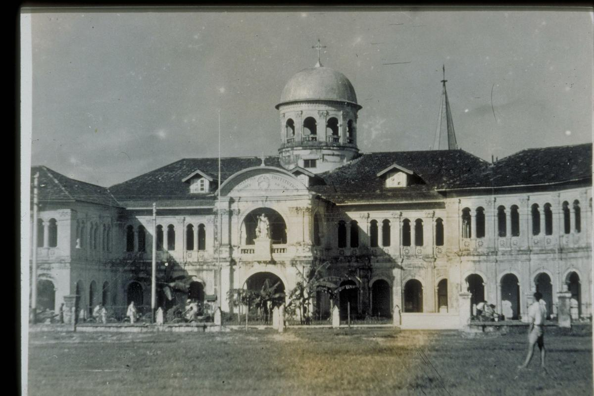
Former St Joseph’s Institution (Singapore Art Museum)
The former St Joseph’s Institution, now associated with the Singapore Art Museum complex, adds another layer to the wartime cityscape. Like several central civic and educational buildings, it was drawn into the upheaval of the occupation years. It helps illustrate how war reshaped the use of familiar city institutions, not just military sites.
Padang
Although you already mention City Hall and the liberation ceremony, the Padang deserves to be named in its own right. This great open field in the Civic District functioned as part of the ceremonial heart of colonial Singapore. Its wartime meaning comes from its proximity to the surrender ceremony and the larger symbolism of civic authority, empire, return, and public memory.
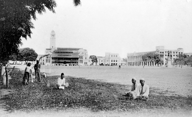
Former City Hall
Former City Hall should be treated as a distinct site from the Padang, even though they are experienced together today. It was here that the Japanese formally surrendered in Singapore in September 1945. Distinguishing it from the Ford Factory helps clarify the chronology: the Ford Factory marks British collapse in February 1942, while City Hall marks Japanese surrender and liberation in September 1945.
St Andrew’s Cathedral
St Andrew’s Cathedral adds a civilian and humanitarian dimension to the story of the city during wartime. Religious buildings often became shelters, medical points, or places of refuge in times of crisis. Including it helps readers understand that wartime Singapore was not only a map of military targets, but also a landscape of civilians trying to survive bombardment and occupation.
Lim Bo Seng Memorial
The Lim Bo Seng Memorial is one of Singapore’s key national monuments connected to the war. It honours one of the island’s best-known resistance figures and gives a clear, accessible focal point for understanding wartime courage outside the usual military chain of command. For many readers, it is one of the most meaningful bridges between historical narrative and national memory.
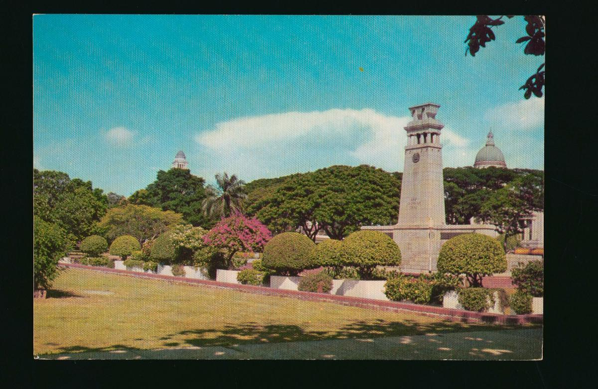
Cenotaph
The Cenotaph is one of Singapore’s most important war memorials and an essential stop in the Civic District remembrance cluster. Originally linked to the First World War, it later became a site of WWII remembrance as well. Its importance lies in how it gathers imperial memory, postwar commemoration, and public ceremony into a single landmark.
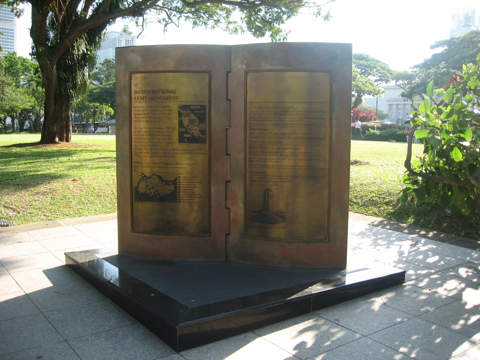
Indian National Army
The Indian National Army site or marker adds an important but often underexplored dimension to Singapore’s WWII story: the role of anti-colonial politics, Indian soldiers, and the shifting allegiances created by the collapse of British rule. Including it broadens the story beyond a simple British-versus-Japanese framing and reflects the political complexity of wartime Asia.
Civilian War Memorial
The Civilian War Memorial is one of the most important remembrance sites in modern Singapore. It commemorates civilian victims of the Japanese Occupation and especially the mass suffering of ordinary residents. If your article wants to connect wartime history with contemporary national memory, this is a crucial stop to include.
People’s Defence Force Headquarters (Beach Road Camp)
Beach Road Camp adds another institutional and military layer to the city-centre story. Its wartime significance helps readers see how barracks, headquarters, and administrative sites were woven into the everyday urban fabric. It also fits well into a walkable city route linking the Civic District to Beach Road and Bras Basah.
Kallang Airfield
You already discuss Kallang in the air-war section, but if you are matching the full WWII trail, it is useful to retain Kallang Airfield as a named standalone stop. The historic terminal building and wider airfield landscape deserve their own map point because they connect civil aviation, military vulnerability, and the opening phase of the campaign.
East: The Guns of Singapore and Captivity
The Changi Museum
You already include Changi Chapel and Museum, which is essential. If you want the article to align more closely with official WWII trail naming, you can refer to the broader stop as The Changi Museum while still using the current museum name in visitor-facing text. It remains one of the most important places in Singapore for understanding captivity, resilience, and everyday life under wartime conditions.
Changi Prison
Changi Prison is distinct from the museum and deserves its own mention. During the occupation, the Changi prison complex and surrounding camps became central to the imprisonment of Allied POWs and civilians. It is one of the best-known names in Singapore’s wartime history and gives the Changi story a more complete and historically grounded frame.
Johore Battery
Johore Battery was one of Singapore’s major coastal artillery sites in the east. It adds an important counterpart to Labrador and Siloso, showing that the island’s defensive gun network extended beyond the south and southwest. It is also useful for challenging simplistic myths about the coastal guns, because it reinforces how large and serious the fixed-defence system actually was.
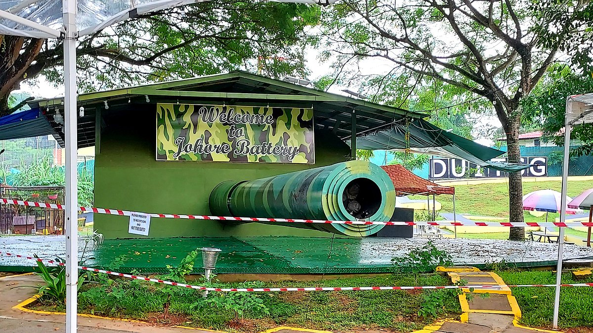
India Barracks
India Barracks forms part of the Changi military landscape and helps show how the eastern part of the island became associated with military accommodation, imprisonment, and captivity. It is not always the first site visitors think of, but it adds important detail to any deeper WWII route focused on the east.
Selarang Barracks
Selarang Barracks is one of the most historically important POW sites in Singapore because of the Selarang Barracks incident, in which Allied prisoners were crowded into the square and pressured to sign a pledge not to escape. It is a key site for understanding the coercive conditions of captivity and the moral pressure placed on prisoners during the occupation.
Roberts Barracks
Roberts Barracks adds another layer to the military geography of Changi. Together with the other barracks in the area, it helps readers understand that wartime Changi was not one single site but an entire cluster of military installations, prison zones, and POW-related locations spread across eastern Singapore.
Kitchener Barracks
Kitchener Barracks completes the picture of Changi as a dense wartime military zone rather than just a museum stop. Including all these barracks gives readers a much clearer sense of scale: captivity in Singapore was spread through a network of camps, barracks, and administrative spaces, not confined to one famous building.
Changi Beach Massacre
You already cover Changi Beach in the occupation section, but it is worth emphasising separately as a massacre site. The calm seafront today contrasts painfully with its wartime role as one of the places associated with Sook Ching executions. It is one of the most emotionally powerful sites on the eastern route.
Pulau Ubin
Pulau Ubin is often left out of mainstream lists, which is exactly why it is such a worthwhile addition. The island formed part of the wider defensive and geographical landscape of wartime Singapore and gives a sense of how the conflict was shaped not only by the main island’s urban centre, but also by its surrounding islands, coastlines, and straits.
Hidden WWII Sites Most Travelers Miss
These lesser-known locations reveal more of Singapore’s wartime past and help fill in the story between the better-known bombing sites, command centers, and memorials.
Kranji War Memorial
Final resting place of over 4,400 Allied soldiers. More than a cemetery, Kranji is one of Singapore’s most important memorial landscapes. It honours the war dead, commemorates those with no known grave, and gives a human scale to a campaign often described only in military terms. It is one of the most moving places on the island to reflect on loss, remembrance, and the cost of the Malayan campaign.
Sime Road Internment Camp Site
Largest civilian internment camp in Singapore. The area also had an earlier military role before becoming associated with civilian internees and prisoners during the occupation. It is important because it widens the story beyond battlefield collapse and shows how captivity, displacement, and long-term confinement shaped wartime life for many people on the island.
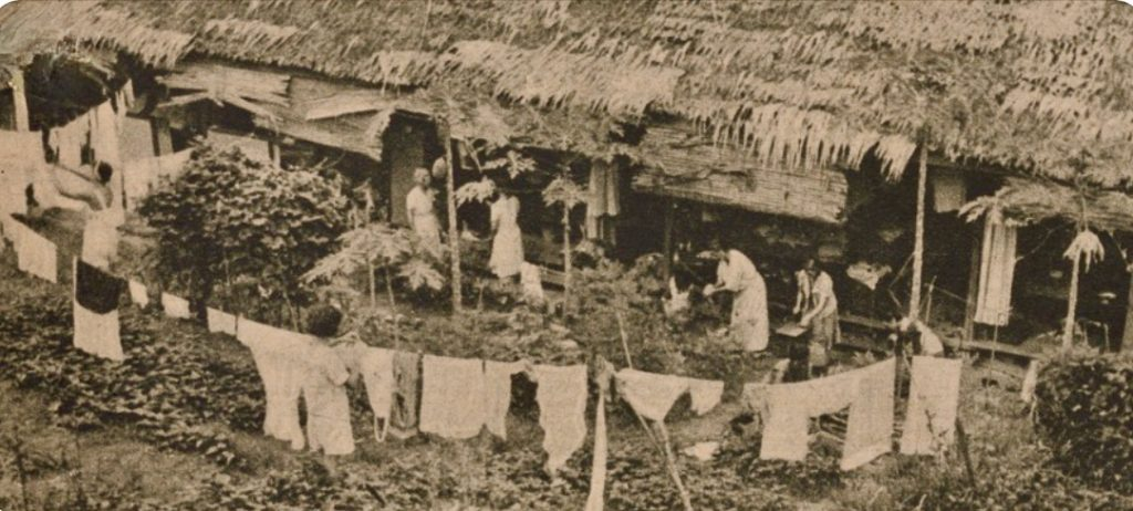
Pasir Panjang Ridge
Part of the Bukit Chandu battlefield. This ridge system was strategically important because it guarded routes toward depots, road corridors, and the Alexandra area. It helps visitors understand that Bukit Chandu was not an isolated heroic stand, but part of a much broader defensive landscape that stretched across the southwestern approaches to the city.
Punggol Beach Massacre Site
Major Sook Ching execution site. On this quiet northeastern shoreline, civilians were taken and killed during the purge. The contrast between the peaceful seaside setting and the violence once carried out here makes it one of the starkest places in Singapore to reflect on the civilian dimension of the occupation.
Marsiling Tunnels
A rare and still somewhat mysterious northern wartime site often linked to military storage and defensive activity near the Woodlands area. It survives more in local memory, exploration lore, and enthusiast discussions than in mainstream tourist itineraries, which is exactly what makes it compelling for travelers interested in obscure wartime remnants.
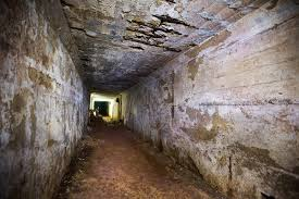
Fort Pasir Panjang Bunkers
Remnants of British artillery defense. These traces, together with surviving nearby pillboxes and gun positions, help reveal how the coastline and southern ridges were fortified before the fall of Singapore. They are easy to overlook, but once you start noticing them, the wartime geography of the island becomes much more visible.
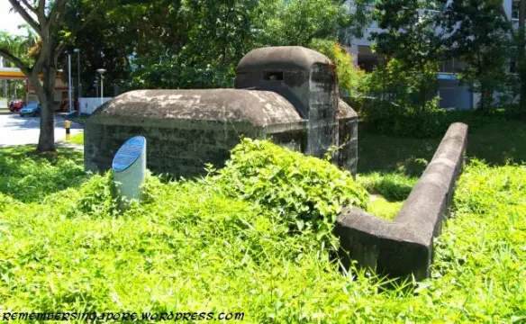
Mount Faber Radar Station Site
Associated with high-ground defence, communications, and observation over the harbour approaches. Today Mount Faber is known for viewpoints, greenery, and the cable car, but in wartime it formed part of a wider network of lookout and fire-control positions tied to the defence of the southern coastline.
A Self-Guided WWII History Route in Singapore
If you want to explore these sites efficiently, follow this route:
Central Route
- Raffles Place
- Battle Box
- National Gallery
- Civilian War Memorial
- Lim Bo Seng Memorial
- Cenotaph
This is the most accessible route for travelers short on time. It takes you from the first bombing to the underground command centre and finally to the liberation ceremony, all within central Singapore. It works especially well as a half-day historical walk and pairs well with the Civic District, Fort Canning, Bras Basah, Beach Road, and nearby museums.
Western Battle Route
- Labrador Battery
- Kent Ridge Park
- Bukit Chandu
- Alexandra Hospital
- Fort Siloso
This route is ideal if you want the most intense battle-focused narrative. It connects coastal defence planning, the Malay Regiment’s last stand, battlefield terrain, and one of the war’s most tragic massacres. Together, these sites tell the story of how the western and southwestern sectors came under crushing pressure in the final days before surrender.
Northern Invasion Route
- Sarimbun Beach
- Lim Chu Kang Landing
- Jurong-Kranji Defence Line
- Kranji Beach Battle
- Bukit Timah Hill
- Kranji War Cemetery
This route follows the invasion from landing to breakthrough to remembrance. It works best if you have a car or are comfortable combining taxis with a longer day out, since these sites are more spread out than the central trail. It is one of the best routes for understanding the military geography of the campaign.
North-East Defence Route
- Singapore Naval Base
- Sembawang Airfield
- Seletar Airfield
- Punggol Beach
- Japanese Cemetery Park
This route works well for readers who want to understand the bigger strategic picture rather than only the final surrender. It links air power, naval planning, memorial landscapes, and one of the occupation’s most painful massacre sites.
Eastern Occupation Route
- Changi Chapel & Museum
- Changi Prison
- Johore Battery
- Selarang Barracks
- Changi Beach
- Punggol Beach
This route shifts the focus from battlefield action to occupation memory. It is quieter, more reflective, and especially powerful for visitors interested in prisoner-of-war history, Sook Ching, civilian suffering, and the lived experience of wartime fear.
Practical Tips for Visiting WWII Sites
Singapore’s tropical heat can be intense, and some of the most meaningful WWII locations are spread across very different parts of the island.
Connectivity: Don't rely on spotty public Wi-Fi while navigating remote areas like Bukit Timah, Lim Chu Kang, or Changi. Getting a Singapore eSIM ensures you have data for maps, ride-hailing, and route planning.
Booking Tours: Sites like the Battle Box often require reservations, so it is worth checking opening days and available slots before you go.
Cluster your visits: The best way to make this guide practical is to group sites by geography. The Civic District, southwest ridge area, north-west invasion zone, and Changi cluster each work well as half-day mini-itineraries.
Visit Fort Siloso:
Fort Siloso
It is the only preserved coastal fort in Singapore.
If you have extra time, Fort Siloso is one of the best add-on stops because it preserves the kind of fortifications many visitors imagine when they think of “Fortress Singapore.” It complements Labrador Battery well, but offers a more extensive and museum-like experience with gun emplacements, tunnels, and preserved military structures.
Why Singapore’s WWII History Still Matters
For the modern traveler, Singapore can seem like a city of airports, skyline views, luxury malls, and efficient transit. But scattered across the island are beaches, bunkers, factories, memorials, ridges, airfields, barracks, and civic buildings where history turned.
Together, these sites explain not only how Singapore fell in 1942, but also how occupation, suffering, resistance, captivity, and liberation reshaped the island’s identity. They show the failure of imperial assumptions, the vulnerability of civilians, the endurance of prisoners and soldiers, and the importance of remembrance in a city that has changed dramatically since the war.
From the underground rooms of Fort Canning to the mangrove shoreline of Sarimbun, these places tell the story of a city that endured invasion, occupation, and eventual liberation — and then rebuilt itself into something very different from the colonial fortress it once claimed to be.
Next time you are passing through Changi Airport, remember that somewhere beyond the skyline lies a battlefield landscape that helped shape modern Singapore.